Dokdo is a tiny rocky island in the middle of the Japanese Sea,....or as Korea refers to it, The East Sea. If you care to read the links (and I cant seem to figure out how to make my links appear in another colour, so I apologize) you can find out a lot of historical and political perspective on this hunk of rock, known in Korea as Dokdo, and in Japan as Takeshima. When I mentioned Takeshima to my friends and former colleagues in Japan, no one knew what the hell I was talking about. I GUARANTEE you, though, you mention Dokdo to ANY Korean and they know EXACTLY what you're referring to~ unless you are mentioning it to your Korean buddy who lives on a mountain under a rock.
I only want to tell you about the fabulous little t-shirt I bought for my niece tonight at Lotte Mart. (Lotte Mart's a big supermarket/department store/complex which also houses TGIFridays in downtown Ulsan.) My beautiful niece just turned 3 at the end of May...

Here she is escaping from the car and her boyfriend Ryan, my friend Andrew's son. Jeepers creepers, where DID she get her peepers? Aren't those some gorgeous eyes?
Anyhow, I like to shop for her here. Korean little girl clothes are adorable! A little too pink for my liking (hello? sex-role stereotyping?) but cute cute cute. Well, today I picked up 4 items, a cute white and purple shirt with ribbons and a princess waist, a pair of super cute purple "skorts," and 2 shirts from the Peanuts line of clothes. One is yellow with a Snoopy-by-numbers cartoon and Woodstock on the back. The other,....well,...it's funny.
It's a Dokdo shirt!
On the front is "proffesor snoopy" pointing at a map on a pull-down screen. On the screen is a map. Korea is noted. The much smaller, scaled-down, and sans-Shimonoseki (the island south of Honshu and east of Kyushu) Japan, is not labeled.
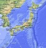
Dokdo is referenced by a dot in the labeled East Sea. Snoopy is pointing to it and thinking, in a thought bubble "DOKDO IS LAND OF KOREA" and below Snoopy it says "world famous proffesor snoopy say,"
Well shit, forget all the historical fighting. If professor snoopy say,....it's gotta be true!
Above the whole cartoon is the caption "DOKDO IS OUR LAND." (And in a box in the bottom corner of the map, it says "MAP OF THE WORLD") Ha ha. That's it folks, South Korea, North Korea, a small chunk of China, Japan's tiny Kyushu and half-of-Honshu and a speck of Dokdo. C'est tout la mode.
On the back of the shirt, up near the collar, is a simple blue cartoon of Snoopy sitting on a rock with a banjo, a couple clouds, a couple music notes, and a South Korean flag. Underneath says 'singing in Dokdo.' Go Snoopy! Sing it!~
I like that my pretty 3 year old niece will be making a political statement in Canada, where no-one will have a clue what her t-shirt means.
I see my kids wearing Dokdo t-shirts, and had been happy, in previous weeks, when the students would use their English skills to try to tell me about Dokdo. Once I figured out what they were saying, I would go up to the board and draw a big hunk of Dokdo looking rock on the board. Pointing to it, I'd say "Dokdo?" and the kids would get all happy, knowing I understood what they said, "Yes! Yes!~"
I'd turn back to the board and draw a little Zola-Jenny (stick Jenny, with curly spirals sprouting out my head and a smiley face,) planting a flag with a curly hair smiley face head on it. Turning back to the students, "Dokdo? Nooooooo. Jenny-do!!"
My students laughed and went politically mental at the same time. I wonder if they went home and told their parents I'd claimed Jenny-do right out from under Korea and Japan.
Professor Snoopy say Jenny-do is Land of Jelly!~

4 comments:
Dokdo Belongs to Korea
□ General Information about Dokdo Island
◦ Geographical Position and Geological Configuration
Dokdo is Korea's easternmost island, situated in the middle of the East Sea, at a latitude of 37° 14' 26.8" N and a longitude of 131° 52' 10.4" E. It is about 47.2 nautical miles (87.4km) east of Ulleungdo (Dagelet), a Korean island.
Dokdo is formed from volcanic rocks. It is composed of two main islets, Seodo ("West Island": 88,639㎡) and Dongdo ("East Island": 73,297㎡), as well as 89 tiny rocks and reefs(25,517㎡). The total area of Dokdo is 187,453㎡.
* Since there are some Korean characters whose phonetic value cannot easily be romanized, Dokdo and Ulleungdo are also written Tokdo and Ulleŭngdo in some documents and maps.
• Name
Dokdo has had several different names throughout Korean history, including Usando, Sambongdo, Seokdo and Gajido (do means island in Korean).
Usando was the most commonly used name for Dokdo in official historical publications. The island was named Usando because the Korean people believed it to have belonged to Usan‐guk (guk means State), an ancient island state which was integrated into Korea's Silla Kingdom.
The name Sambongdo, which means "island of three peaks," is related to the geographical features of Dokdo. It was recorded that Dokdo appeared to be a three‐peaked island, if it was seen from a certain angle.
Gajido stems from an old Korean name for seals, gaji, which were abundant in the waters off Dokdo.
Seokdo and Dokdo are two different Chinese translations of the same Korean word, Dokseom, meaning "rocky island" in the dialect used by the inhabitants of Ulleungdo. During the Joseon Kingdom, most official documents were written in Chinese characters. When it was translated into Chinese ideographs according to the meaning of the word, Dokseom became Seokdo. When translated into Chinese ideographs on the basis of its pronunciation, Dokseom became Dokdo.
In the 19th century, European sailors who explored the seas around Korea gave Western names to many Korean islands, including Dokdo, since their Korean names were unknown to the Europeans. Dokdo was named Liancourt Rocks after the French whaler, Liancourt, which explored the sea around the island in 1849. The foreign name, Liancourt Rocks, still continues to be used in some Western books and maps.
• Ecosystem
Dokdo has a unique ecosystem. Its volcanic rocks, partially covered with thin soil and moss and producing a small amount of fresh water, serve as a habitat for some 70~80 species of plants, 22 species of birds and 37 species of insects. Its surrounding waters, where cold and warm ocean currents meet, are home to a community of marine living organisms, including seals and as many as 100 species of fish.
• Administration
Because of its proximity to the bigger neighboring island Ulleungdo, which has an area of 73㎢ and about eleven thousand inhabitants, Dokdo administratively belongs to Ulleungdo. Dokdo's address is San 1~37, Dokdo‐ri, Ulleung‐eup, Ulleung‐gun (county), Gyeongsangbuk‐do (province), Republic of Korea. The Korean Government keeps a manned lighthouse and a quay on Dokdo.
In an effort to preserve the natural environment and ecosystem of Dokdo, the Government of the Republic of Korea designated it as a "Natural Protected Zone" in 1999 in accordance with the Protection of Cultural Properties Act. In 2000, under the Special Act on the Preservation of the Ecosystem of Dokdo and other Island Groups, Dokdo was designated as a "Special Island."
□ History of Dokdo
◦ Consolidation of Korean Sovereignty over Dokdo
In 512 A.D., the Silla Kingdom conquered Usan‐guk (Usan State), of which the main part was Ulleungdo. Since then, the Korean people have considered Dokdo to be a part of Ulleungdo.
The subsequent Korean states, namely the Goryeo Dynasty (918~1392), the Joseon Dynasty (1392~1897), the Daehan (or Korean) Empire (1897~1910) and the Republic of Korea (since 1948), have exercised sovereignty over Dokdo.
◦ Historical Documents Proving Korea's Sovereignty over Dokdo
Among the numerous historical documents showing that Dokdo has been an integral part of Korea since ancient times, the following are the most important official documents:
Samguksagi(History of the Three Kingdoms) is an official history book written in 1145 A.D. on the Three Kingdoms of Korea, namely the Silla (57 B.C. to 935 A.D.), Goguryeo (37 B.C. to 668 A.D.), and Baekje (18 B.C. to 660 A.D.) kingdoms. This book, edited by Kim Bu‐sik, a historian and the then prime minister of the Goryeo Kingdom, contains the story of the conquest of Usan‐guk in 512 A.D. by Isabu, a general of the Silla Dynasty under the reign of King Jijeung.
* Sillok, which is mentioned in the following references, means annals, or historical records, compiled and published by the government throughout the time of the Joseon Dynasty. Each king's name was added before the word sillok, in order to indicate that it covered the history of the Dynasty during the reign of that king.
Sejong Sillok Jiriji was compiled as part of the Annals of King Sejong (1418‐1450) of the Joseon Dynasty. The Jiriji (geography book) contains a variety of information needed to govern the country, such as the administrative history of each local government, the topographical features of administrative units, their populations, and roads. The book refers to Dokdo and Ulleungdo as follows: "Usan [Dokdo] and Mureung [a former name of Ulleungdo] are located in the middle of the sea, due east of this Prefecture. These two islands can be seen from each other in good weather, as they are not far apart."
According to Seongjong Sillok, the Annals of King Seongjong (1469‐1494), an official investigative team sailed for Sambongdo (Dokdo) and reported to the royal court as follows: "We dropped anchor at seven or eight li [about three kilometers; one li equals 400 meters] west of the island… We drew a picture of the island and came back."
Sinjeung Donggukyeojiseungnam(The Revised and Augmented Version of the Survey of the National Geography of Korea) was published in 1531 as an enlarged edition of the 1481 Donggukyeojiseungnam (Survey of the National Geography of Korea), which dealt with Korea’s cultural geography, such as historical figures associated with different areas and poetical works inspired by the local scenery. As in the above‐mentioned excerpt from Sejong Sillok Jiriji, this book describes Dokdo and Ulleungdo as part of the Korean territory in the East Sea, and states: "The two islands are located in the middle of the sea, due east."
According to Sukjong Sillok, the Annals of King Sukjong (1674‐1720), Ahn Yong‐bok rebuked some Japanese fishermen for staying at Ulleungdo and Dokdo and warned them against returning to these islands in the future. Sukjong Sillok further records that Ahn Yong‐bok went twice to Japan in order to protest against Japanese nationals trespassing into Korean territory. He asked the Japanese authorities to recognize Korea's sovereignty over these islands and to forbid Japanese nationals to sail to these islands. Consequently, the Japanese Government prohibited its nationals from sailing to the Ulleungdo region.
Jeongjo Sillok, the Annals of Jeongjo (1776‐1800), reports that, following Ahn Yong‐bok’s actions, inspectors were dispatched every three years by the Government to Ulleungdo and Gajido (Dokdo).
Imperial Decree No. 41 was issued in 1900 by Emperor Gojong (1864‐1907) of the Daehan Empire as a measure to reform the traditional administrative system. This Decree placed Dokdo under the jurisdiction of the Ulleungdo County office. The Decree stipulates: "…the Headman of Uldo [a newly designated County of Ulleungdo] shall have jurisdiction over Ulleungdo, Jukdo and Seokdo [Dokdo]…"
□ Korean Sovereignty over Dokdo, Lost and Regained
From the end of the 19th century to the beginning of the 20th century, Japan pursued a policy of imperialistic expansion. Japan won the Sino-Japanese war in 1894 and the Russo-Japanese war in 1904; the main issue at stake in both wars was control over Korea.
After having beaten off its two colonial rivals, Japan forced Korea to become its protectorate in 1905, and finally annexed Korea by force in 1910. In the course of this imperial aggression, the Shimane Prefecture, a Japanese local authority, adopted a municipal ordinance to incorporate Dokdo into its jurisdiction without legal foundation and without notifying any state concerned.
In this way, the invalid acquisition of Dokdo by Japan was conducted in the process of and as a part of Japan's annexation of Korea.
After the Second World War, Korea, being liberated from Japan, recovered its territory, including Dokdo. During and after the Second World War, the Allied Powers adopted a series of documents which contained provisions intended to make Japan return the entire pre-colonial Korean territory, including Dokdo, to Korea. These provisions are as follows:
The 1943 Cairo Declaration states: "Japan will also be expelled from all other territories which she has taken by violence and greed".
The 1945 Potsdam Declaration declares: "Japanese sovereignty shall be limited to the Islands of Honshu, Hokkaido, Kyushu, Shikoku, and such minor islands we determine."
When it surrendered to the Allied Powers in 1945, Japan unconditionally accepted the Potsdam Declaration. The Allied Powers have never subsequently determined that Dokdo is part of the territory of Japan.
The 1946 SCAPIN (Supreme Commander for the Allied Powers Instruction) No. 677 specifically excludes Dokdo (referred to as Liancourt Rocks) from Japan's territory as follows: "For the purpose of this directive, Japan is defined to include: the four main islands of Japan... excluding Utsuryo Island(Ulleungdo), the Liancourt Rocks(Dokdo) and Quelpart Island(Jejudo)."
The 1951 San Francisco Treaty of Peace with Japan stipulates in Article 2(a): "Japan recognizing the independence of Korea, renounces all right, title and claim to Korea, including the islands of Quelpart(Jejudo), Port Hamilton(Geomundo) and Dagelet(Ulleungdo)."
Although there are about 3,000 Korean islands, these three major islands are the only ones mentioned in the San Francisco Treaty. The fact that Ulleungdo (referred to as Dagelet) is one of the islands mentioned would indicate that its smaller neighboring islands, including Dokdo, were implicitly included into the above provision of the treaty.
□ Korea's Exercise of Sovereignty over Dokdo
Since its establishment in 1948, the government of the Republic of Korea has been taking full control over Dokdo, a group of islets located in the East Sea. Based on its legal rights over the islets, it has stationed garrison and deployed patrol boats and other ships with a mission to guard Korea's eastern territorial sea, contiguous zone, and exclusive economic zone. It has also adopted measures to preserve its natural environment.
Korea's sovereignty over Dokdo is complete, both de jure and de facto, that cannot be shaken by any unfounded foreign claims. Dokdo is not an object of territorial dispute.
As part of the efforts to reinforce its sovereignty, the government plans to deploy helicopters and military vessels around the islets to beef up existing patrol of the area and counter unauthorized visits by Japanese.
Currently, a team of 37 Korean combat police officers are guarding the islets, while maritime police and naval vessels are patrolling around them.
The government has also drawn up various contingency plans, which will be followed by concrete steps to reinforce security in the seas and skies of the islets. Korea's maritime police will place their SWAT teams on the ships.
In addition, the government will spend 2.2 billion won by September 2005 to repair dock facilities for ships and roads for civilian visitors on Dokdo.
Senior government officials, police, and lawmakers have rushed to visit Dokdo after the government decided to ease travel restrictions in mid-March. Once the bans on civilian visits are removed, about 5,600 people are expected to visit the islets annually.
The Korea Meteorological Administration (KMA) will set up an earthquake and tsunami observatory on Dokdo by 2007 to enable Korea to better cope with natural disasters, a decision made on March 21, one day after a quake off Japan hit west of Japan's Kyushu Island, measuring 7 degrees on the Richter scale.
* Resource Acknowledgement : Korea.net(www.korea.net/News/Issues) run by the Korean Overseas Information Service (KOIS) of the Government Information Agency
what???
Hi dear people in Korea,
I would like to say a shocking thing for all of you.
To tell the truth, Dokdo is not Korean territory.
I am serious. Becauae Usan-do is not Dokdo, as old documents said that there were people living in Usan-do it can't be Dokdo, as everyone knows Dokdo has no soils, no trees, no bamboos...there has not been residents. And Sambongdo is Ulleungdo, as old documents stated (you can understand if you read the cocuments yourself)...Gajido is a small island beside Ulleungdo. Sealions were living around Ulleungdo in old times, you can read yourself...so no one can't say the island on which sealions living was Dokdo.
So I would like to inform you that there is NO evidence that Koreans knew Dokdo since old times. Look at the shape of Dokdo in old Korean maps...there is NO map that depicted two rock islets while Japan had numerous maps of two rock islets since 17th century.
So actually Korea didn't know Dokdo until 20th century.
But Korean government kept brainwash Korean people, teaching that "Dokdo id ours" in schools, but this was false.
You should awake from the brainwashed state!
Post a Comment